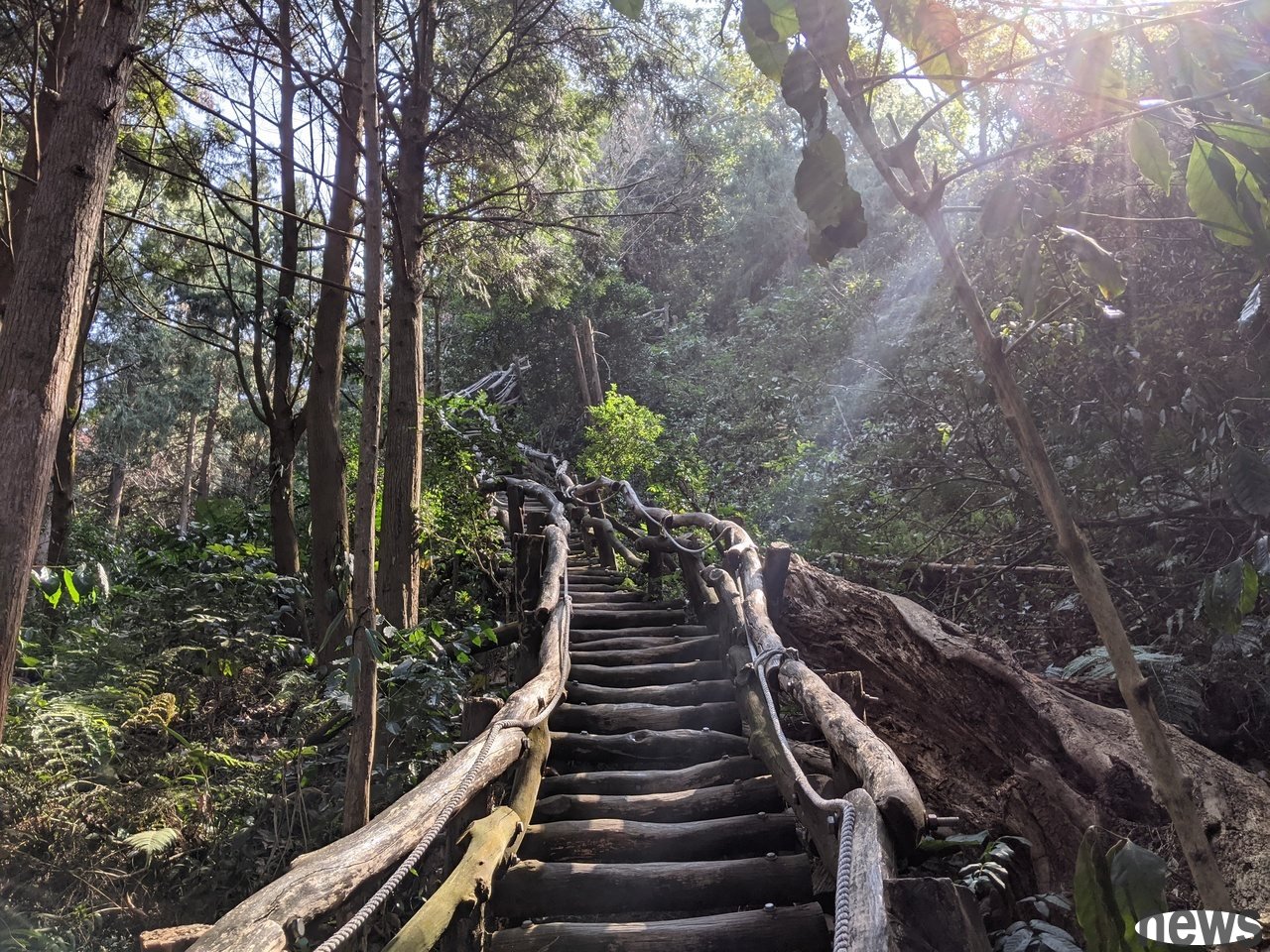
When I don’t want to have a holiday, I’m waiting at home, where can I go? In fact, there are unique trails in all parts of Taiwan. In addition to being able to move your muscles and bones, you can also enjoy different beautiful scenery.
But there are so many trails, how to choose a route that suits you? The "Taiwan Top 100 Must-Advisor Trails" on the website "Hiking Notes" are selected by nearly 1 million votes across Taiwan. The selected trails include high-altitude Taiwan's 100-month-level, slightly challenging intermediate mountains, and easy-to-go trails, suitable for various ethnic groups. The following are the trails that can be used to travel around the same day for Yuanqi.com:
Keelung Trail. The Forget Valley Trail
Wanggu is a V-shaped valley. You can relax in the green grasslands and see the boats coming from Badouzi Hang Harbor, as well as Keelung San far away. At this point, tourists walk on the valley grasslands and the valley trails, walk on the cliffs, overlook the sea and sky, overlook the sea platform tofu rocks under the cliffs, and also the majestic and visible cliffs. At night, the sea points on the sea surface are divided into the fire points and the lights of Jiufen Mountain City, forming a beautiful mountain and sea scene. 》See more
Trail length: 1.7 kmLocation: Zhongzheng District, Keelung City
Required time: 1 hour
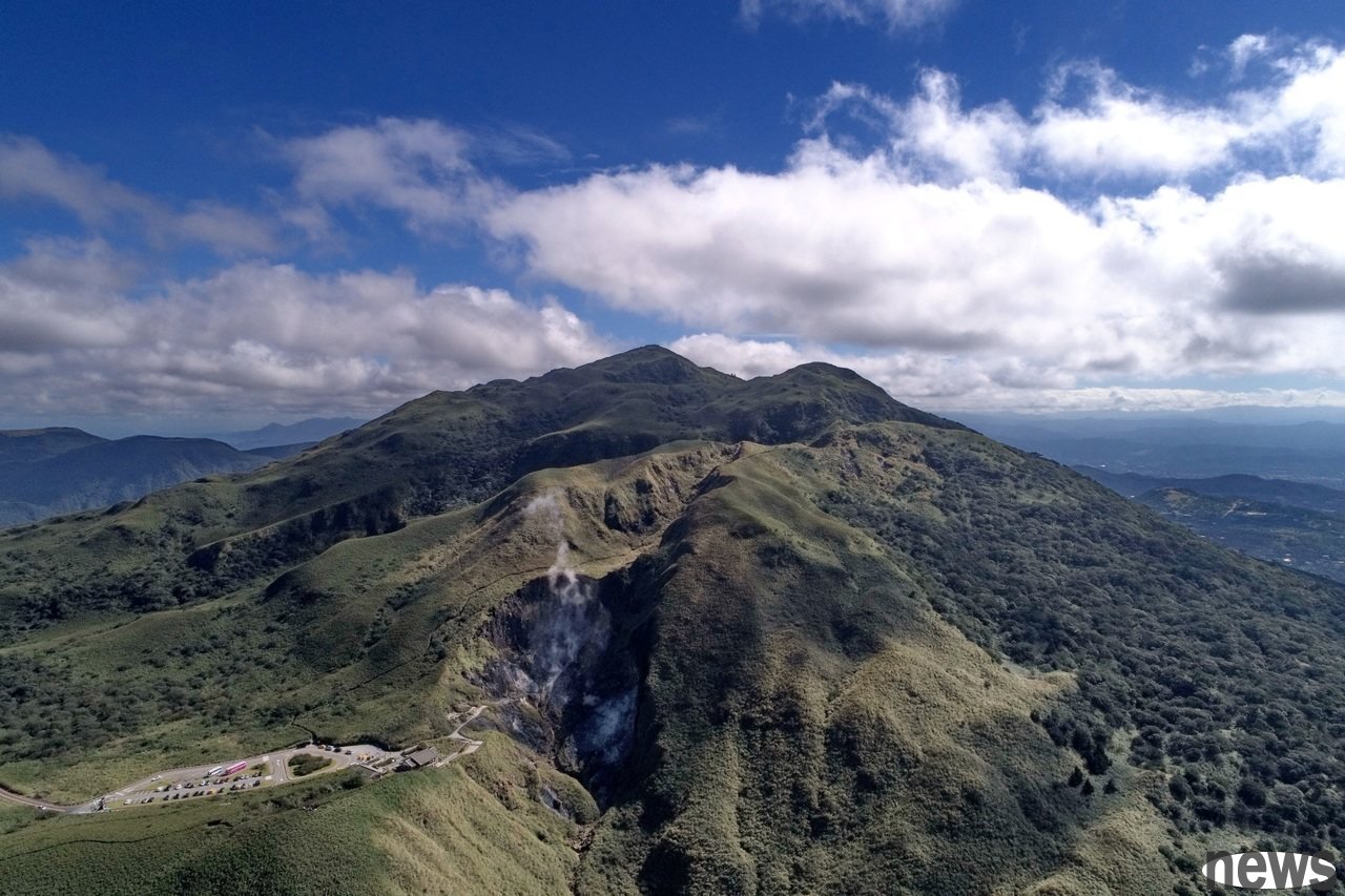
. Qixing Mountain's main peak and Dongfeng Trail
Qixing Mountain is named after the violent activity of volcanic dramas. After cooling and solidification, it forms seven igneous rock heads of varying sizes at the crater. The main peak is about 1,120 meters high, which is the highest peak of the Yangmingshan National Park. The Seven Star Main Peak-East Peak Trail spans the north and south sides of Qixing Mountain and can enter from three mountain passes including Xiaoyoukeng, Lengshuipu and Nursery. Among them, we move from the Xiaoyoukeng mountain climbing entrance to the southeast, and go to famous scenic spots such as the Qixing Main Peak, the East Peak, the Qixing Park and the Dream Lake. Finally, we arrive at the Lengshuikeng mountain climbing entrance. The other route can reach the nursery mountaineering entrance from the Xiaoyoukeng mountaineering entrance to the nursery mountaineering entrance, mainly traveling to the main peak of Qixing. It is also from the Tingchao intersection of 3.7 kilometers of Nursery Trail, Tingchao Road, and can be connected to Qixing Park, Dream Lake and other points. 》See more
Trail length: 4 kilometersLocation: Beitou District, Taipei City
Required time: 2 hours 30 minutes
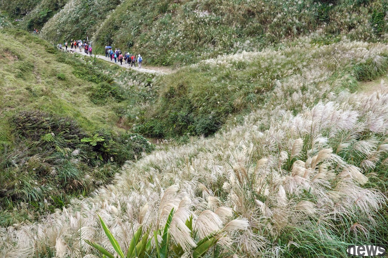
. Caoli Ancient Road
Caoli Ancient Road is one of the sections of the ancient roads opened by our ancestors. The most well-known one is the mountainous road from Far Wangkeng, Wancheng Town, Yilan County, to Dali, Yilan County. The journey passes through Caoli at the junction of New Taipei City and Yilan County, and passes two important stone tablets along the way, which makes this "Cali Ancient Road" famous. The ancient road is built on the southern road technology. After Japanese people's broad and brightness, the management office in the Northeast corner promotes the flower season after autumn, making the ancient road a hiking trail that is loved by the people. 》See more
Trail length: 8.5 kilometersLocation: New Taipei City, Touliao District, Yilan County Head Town
Required time: 4 hours
. Dongyan Mountain self-guided trail
Dongyan Mountain Forest Game District is located in the revival area of Taoyuan City. It belongs to the end of the snow-capped mountain. Looking from Amping, Taoyuan, the mountain shape looks like a lying girl looking towards Dong with her big eyes, allowing the name "Dongyan Mountain" to walk without love. The entire game area covers nearly 1,000 kilograms, and contains a sea of cypress trees that extend more than 300 kilograms. The area is the highest area of "Tongyan Mountain", which is 1,212 meters above sea level. From the top of the mountain, you can enjoy the surrounding mountain scenery and overlook the scenery of Taoyuan, Sanmao, Tamsui River and other scenery. It is also a good place to enjoy the night view of Taoyuan. 》See more
Trail length: 3.5 kilometersLocation: Taoyuan City Restoration Zone
Required time: 2 hours
Hsinchu Trail. The entrance to the 飞沪无机月月月月月月天月天场月天场月, and is finally located at the parking lot of Hua Temple in Huanen. Along the lines, there are various plant landscapes such as Fengxiang, Wuliu, Jiuxiong, camphor trees, mountain flowers, Acacia tree, Duying, and Black Pine. The scenery is rich and beautiful. The road is covered with green and quiet, quiet and refreshing, suitable for mountain climbing and hiking at dusk. Climbing high places you can see the coastal scenery of Hsinchu, and the sunset is sunny in the west, which is pleasant. 》See more
Trail length: 3 kilometersLocation: Xinfeng Township, Hsinchu County, Zhubei City, Hsinchu County
Required time: 1 hour 40 minutes
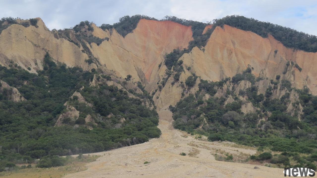
. Huoyan Mountain and Nan'an Ancient Road O-shaped walk
Huoyan Mountain is a rare marvelous wonder in Taiwan. The rocks on the peaks are exposed and there are few vegetation. The red cliffs and walls are like an alien planet. From a distance, it looks like a raging fire is burning, as if entering the "moon world", so it has the seal of the Taiwan version of the Damascus Valley. Huoyan Mountain is 602 meters high, and most of the trails are stairs made of soil and stone blocks. They are mostly uphill sections along the way, but most of them are covered by trees and forests, which are comfortable to walk. However, some sections are narrow and steep, and the earthquake is fragile, which can be seen as if walking on a cliff. 》See more
Trail length: 6.4 kilometersLocation: Sanyi Township, Miaoli County
Required time: 3 hours
Central Chapter
. The No. 4 trail
at the site of Dakeng Trail
has a very large slope drop. One of the vertical steep slopes is about 300 meters long to test the strength and endurance of tourists. It is called "soft slope". Due to the earthquake, the vegetation surface in the middle of the trail is less, and the mountain trail is winding, and the far view is like a long city in Wanli. It is located in a high place to challenge tourists' awareness. Finally, it can connect to the highest point of the No. 5 trail - the Head Pavilion. 》See more
Trail length: 1.9 kmArea: Beitun District, Taichung City
Required time: 2 hours 40 minutes
. During the Japanese reign, due to lack of traffic, most of the residents of Songbailiu bought and sold to Ershui Street. The mountain they produced was cut from the mountain beside the Shoutian Palace and passed through the early trading path "Mi Lu Lane", along Shitaokengzai (now Fengbai Road) to Ershui Street for sale, and then bought the required daily necessities and went back to the top of the mountain. To facilitate walking, enthusiastic people expand the "Breast Touching Lane" to make the dark and narrow mountain passages turn into brighter and wider mountains. After that, residents of Songbaili no longer traveled to Ershui to buy and sell, and the trails were all tourists who were leisure and fitness, and the scene of "porters" that used to be crowded has become a history. 》See more
Trail length: 1.7 kmLocation: Ershui Township, Changhua County,
Required time: 50 minutes
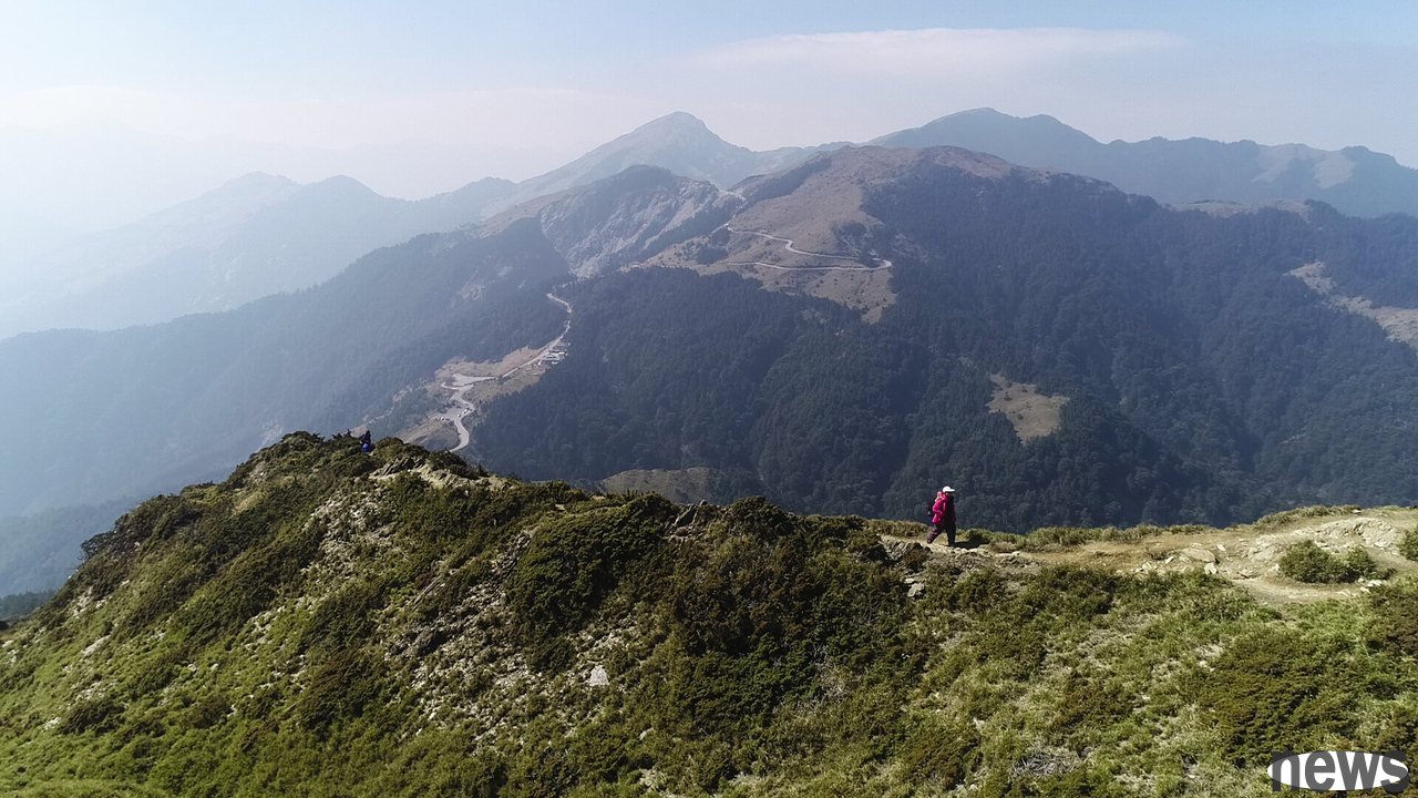
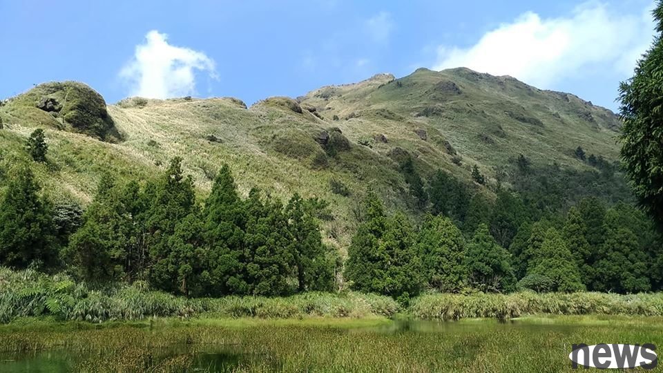
. The Heihe North Peak Trail
Beihehe Mountain is 3422 meters above sea level. It is the highest mountain among the Heihe Peaks and one of the mountains on the western boundary of the Tailuguan National Park. From the east side, from the Jinma Tunnel on the Zhonghen Highway to the Dayu Ling, or from the Heishan Mountain along the Taisijia Highway to the small entrance, you can clearly see the vertical mountain shape of the Beiheshan Mountain. It is close to the top of the mountain, and a giant reflector plate is erected. This can be said to be the mark of the Beiheshan Mountain and is very easy to identify. Together with the green fir forest, weaving the earth. In spring and summer, there is no place where there is no sea of flowers. 》See more
Trail length: 2 kilometersLocation: Renai Township, Nantou County, and Xiulin Township, Hualien County,
Required time: 3 hours
Southern Chapter
. Yunjia Dajian Mountain and Erjian Mountain Trail
Erjian Mountain is located in Meishan Township Longyan Village, Jiayi County. It is the secondary peak of Dajian Mountain, 1,274 meters high. It starts from Zhuzai Cen, and walks along the Dajian Mountain line, passing through the first-class triangle point of Dajian Mountain with an altitude of 1,304 meters. Then slowly descends downhill and arrives at a good place for climbers to rest. Another mountain pass is from behind Longxing Palace, climbing along the sleeper trail. Apart from bamboo forests and shirts, it is even more fragrant when traveling through the tea garden. Every year when the cold waves come in late autumn and early winter, there is a chance to see the vast clouds and stroll along the trails, making people feel like they are in a paradise. Dajian Mountain and Sea Grain is 1,299 meters, with a first-class triangle point cornerstone. The two are located on the top of the mountain, about 15 minutes apart. To the Gukeng, you can overlook the Yunjia Plain and the Qinglang Tree, to the Meishan Mountain, you can overlook the valley and the tea garden, and you can also look far away from the grass shore, which is a great view. 》See more
Trail length: 7.8 kmArea: Gukeng Township, Yunlin County, Meishan Township, Jiayi County
Required time: 3 hours 30 minutes
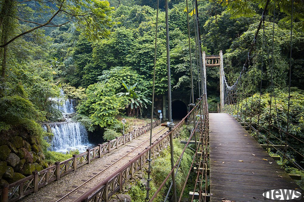
. The independent mountain national trail
The mountains in Chiayi County are connected, but the only one who stands alone, hence the name. The formerly known as the Independent Mountain Trail was the Independent Mountain Trail. It was the earliest ancient road that was used to send daily necessities at the foot of the mountain to the mountain. During the Japanese reign, the Alishan Railway was built to transport forestry and reached the top of the mountain for three weeks in the independent mountain. The Independent Mountain Ancient Road is planned as the Independent Mountain National Trail, which is difficult and low in degree and is suitable for family members to travel together. Along the way, you can see valleys, iron paths, tunnels, and hanging bridges, and the scenery is changing. The spiral path that spirals up three times is a unique landscape. 》See more
Trail length: 3.5 kmArea: Zhuqi Township, Chiayi County
Required time: 2 hours
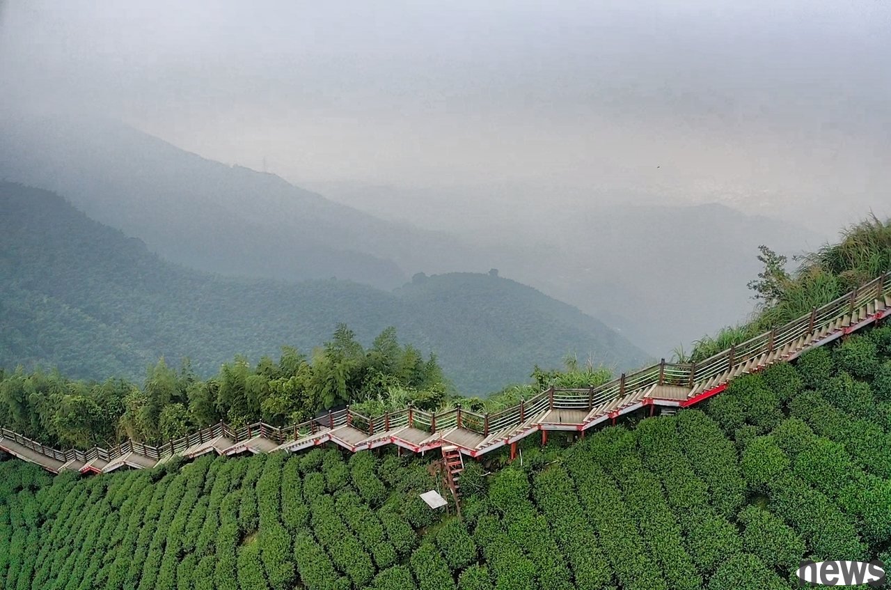
. Meifeng Ancient Road
Meifeng Ancient Road is a major transportation route from Nanhua Guanshan District to Nanxi. It is composed of marble and stone staircases. The starting entrance is located next to the parking lot of the public dining and B&B. The flowers and plants are lush and the environment is rich. In May, you can also see a large area of locally rejuvenated Taiwanese lilies. The higher you go up the ancient road, you can see dense and tall trees, with ferns surrounding it long and dense, as if you step into the forest of the Dzi era. The atmosphere is mysterious and it is a forest scenery that tourists must not miss. 》See more
Trail length: 2.2 kmLocation: Nanxi District, Tainan City
Required time: 2 hours
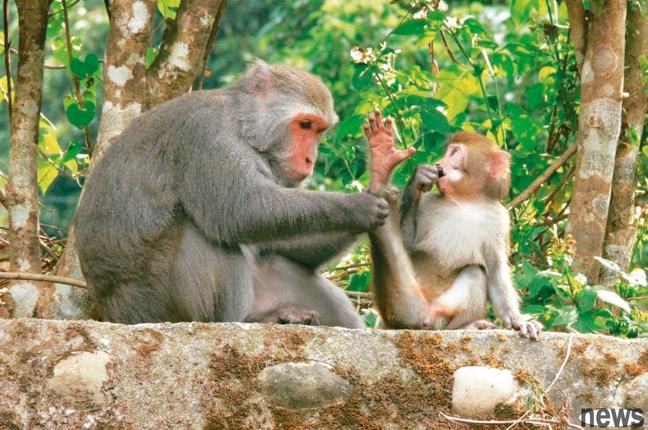
. Chaishan Trail (Korean Chaeshan)
Chaishan is also known as Kanshan and Dagou Mountain. It has unique limestone rugged terrain and coral reef vegetation, and precious prehistoric Betsuka. Due to long-term military control, a natural and cultural ecological library that has not been destroyed has been formed. In the forest of more than 1,000 hues in Chaishan, there are more than 900 native plants, including the rare and rare Taiwanese seaweed, dense hair konjac, small lemon, chrysanthemum trees, pine leaves, etc. At the same time, it also breeds a variety of rare wild animals, kennels, birds, claws and a wide variety of cattle, of course, and the most famous Taiwanese monkeys. 》See more
Trail length: 5 kilometersLocation: Gushan District, Kaohsiung City
Required time: 3 hours
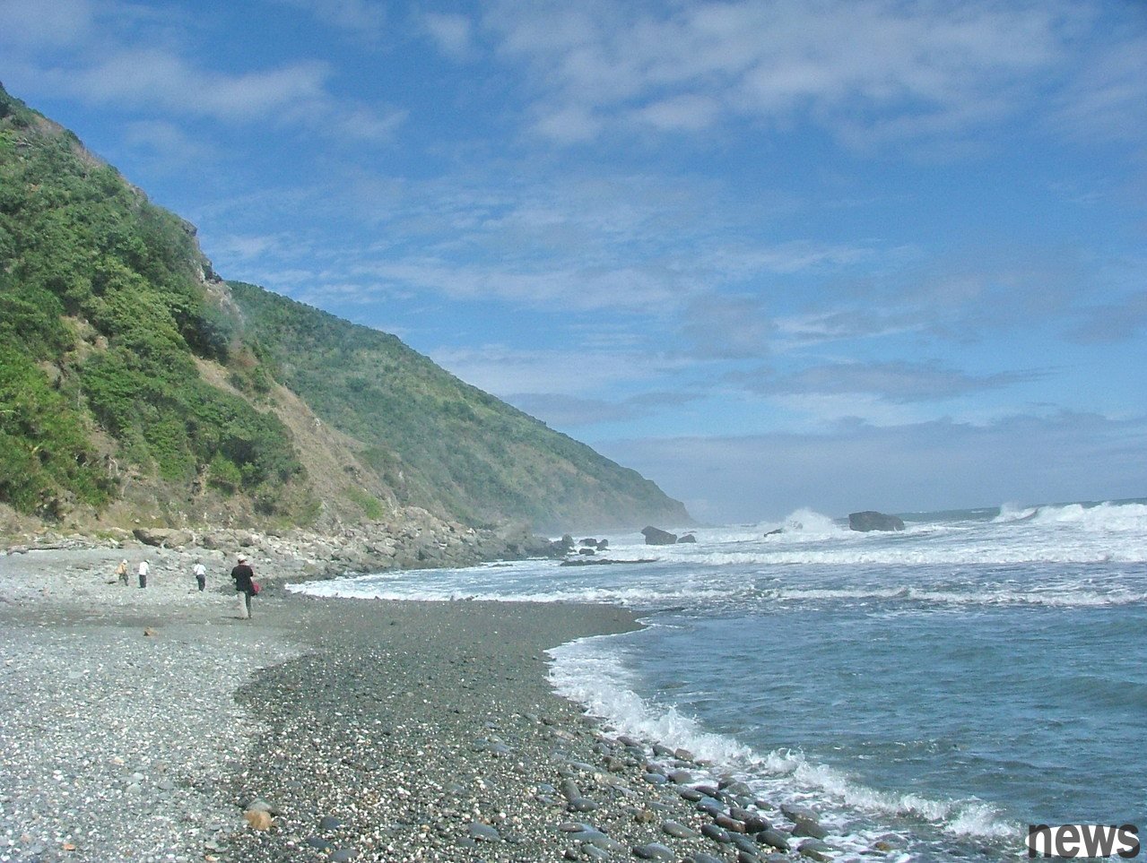
. Alang Yi Ancient Road (Langliang Beinan Road) (requires reservation application)
Alang Yi is the old name of the Anshuo tribe in Daren Township, and the distance from Xuhai to Anshuo is called "Alang Yi Ancient Road". This section of coastline is currently a small area in Taiwan where no roads are open. The ecological environment is well preserved and has rich animal and plant resources.. In terms of natural landscape, the Ahnyi Ancient Road extends to the Taiwan coast and has not yet been developed, making the coastal scenery here quite complete, especially the long stone beach on the shore, a circle of pebbles with different sizes and falls on the shore, like piles of stone plates. 》See more
Trail length: 7.2 kilometersArea: Peony Township, Pingtung County, Daren Township, Taitung County
Required time: 4 hours
East Chapter
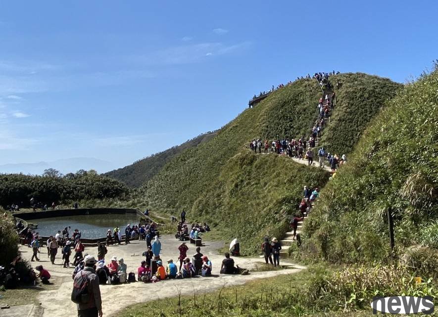
. The Sanmu Mountain Mountaineering Trail (Matcha Mountain)
The Sanmu Mountaineering Trail is located above the Wufengqi Waterfall Scenery Area in Jiaoxi Township, Yilan County. It is a Catholic road to the sacred road, and it is also a stop in the Triangle Mountain, one of the Five Mountains of Lanyang. The final viewing platform is the administrative boundary between Yilan and Taipei, with the east ridge and snow-capped mountains and green mountains in the west; while the wind is greeted by arrows, bamboo, green sea, and rustling, so beautiful that people can't return. 》See more
Trail length: 5.33 kilometersLocation: Jiaoxi Township, Yilan County,
Required time: 5 hours
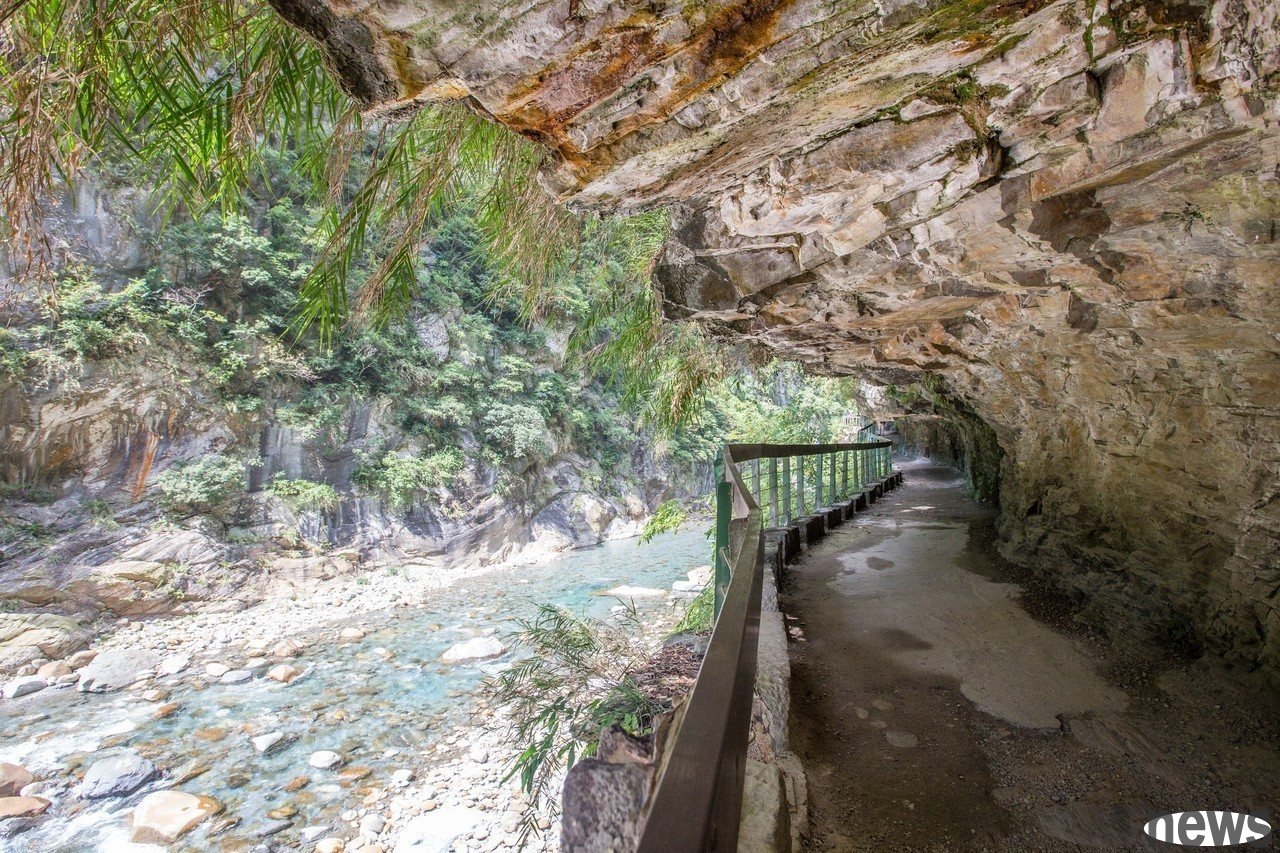
. The Shakale Trail
The Shakale Trail is leaning against the Shakale Stream. In the 16-kilometer road of the Shakale Stream, a steep valley is formed, with clear streams, beautiful rock folds and heavy forests. There have been many indigenous settlements along the trail, which makes the Shakale Trail both landscape, ecological and humanistic beauty. The bed of Sakaya River is filled with large and small slabs, with the most marble and gneiss. The rapid stream water slid across the bed, playing a clear natural sound with the stream stones, and the stream water also polished the rocks smoothly and softly. The pleats form abstract wall paintings on the mountain walls and the rocks in the stream, allowing people to appreciate the imagination. 》See more
Trail length: 4.5 kilometersArea: Xiulin Township, Hualien County
Required time: 3 hours 20 minutes
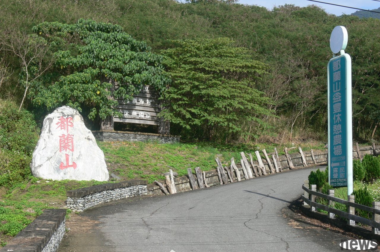
. The Dulan Mountain Trail
The Dulan Mountains are rich in forests. When climbing, you can see many tall straight and trunk trees, the Nine Domes with smooth skins, snake wood, gold lan, bamboo cypress lan, etc. You can also see many plants commonly used by local indigenous people, such as the fake acid stew that the Amei people usually use to wrap glutinous rice. As the trail continues to climb upwards, the forest patterns of Dulan Mountain also change with different heights. Because the environment is damp, there are many vines in the forests of Dulan Mountain, which looks like the scene of the movie "Tarzan". 》See more
Trail length: 3.8 kmLocation: Donghe Township, Taitung County, Time Required: 5 hours 30 minutes
Waishima ChapterMazu Trail. Luoshan Nature Trail
is located in the Luoshan Nature Trail between mountains and seas. It was a small walk that Hou Ao residents often walked on oysters and tourists. It was along the cliff and the stairs were steep. It took about 40 minutes to return. There were two scenic spots along the way, and you could finally see the statue of Confucius on the sea; Due to the influence of the wind blowing of the season, the growth of the trail vegetation is limited. The vegetation of the sacred tree (sacred tree) listed as a rare conservation type of Mazu can be seen everywhere. It is also because it is blown by the wind of the northeastern sea for many years, which has produced a unique "shearing effect". The tree is as elegant as a bonsai, showing the beauty of rugged and sacred. 》See more
Trail length: 0.85 kmArea: Beigan Township, Lianjiang County
Required time: 50 minutes